How 3D Laser Scanning Works
Learn More about Laser Scanning and How It Was Used at Fort Conger
How Do Laser Scanners Work?
Laser scanners emit a pulse or laser beam of light that strikes the surface of an object, such as an artifact or building. The instrument then measures the beam’s “time of flight,” recording the time it takes for the beam to strike a surface and make its return. With two mirrors, the scanner calculates the beam’s horizontal and vertical angles, giving accurate x, y and z coordinates. This is done millions of times, creating a dense three-dimensional cloud of points in a coordinate system that forms the shape of the objects being scanned.
The resulting point clouds provide highly accurate baseline information that can be used to reconstruct and repair historic structures, as well as monitor site degeneration through time. Laser scanning provides a method of rapidly and accurately recording an entire site. Point clouds can also be used to create virtual worlds containing 3D models and computer animations for the purposes of education and public outreach. For example, many of 3D reconstructions in this website were created from point clouds.
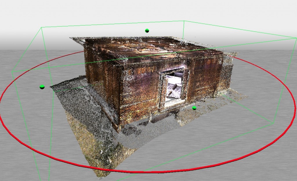
In order to create this complete point cloud of a hut occupied by Matthew Henson, Peary’s associate, the laser scanner had to be set up at several different locations around the structure. Targets attached to the walls of the hut, and arranged on tripods around the building, were then used to tie each point cloud together.
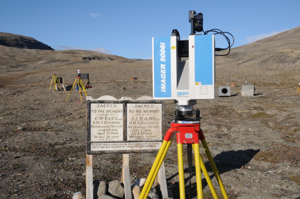
Like a standard camera, laser scanners have a field of view, meaning that other entities can occlude (get in the way of) objects being scanned. When buildings are clustered together, for example, the wall of one structure may obscure portions of another. Consequently, the scanner must be set up in a variety of different locations to ensure that all surfaces of the building have been captured. These point clouds then need to be linked together in order to create a single 3D point cloud. In order to do this, a series of targets are set up around the site so that the operator knows which point clouds are from which object. The latitude and longitude of these targets is also recorded using a Geographic Positioning System (GPS). This allows each point cloud to be accurately located on a map.
There are different types of laser scanners. High-resolution scanners usually have very short ranges of only a few centimeters and operate at .00002 mm accuracy. Mid-resolution scanners have ranges about 5 m or less, provide resolutions of .03 mm, but are sensitive to light levels. Long-range scanners have a range of more than 100 m and use advanced techniques such as echo digitization and online waveform processing to achieve higher resolutions. These scanners can capture objects the size of buildings, and operate under a wide variety of lighting conditions.